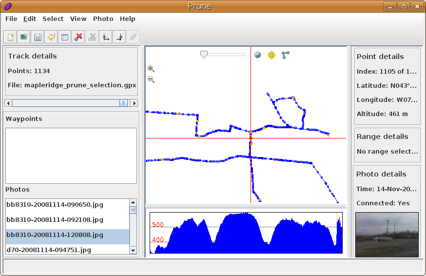
I don’t like prunes, but I do like prune


Just spent a pleasant morning munging gps data and photos using Prune. It has allowed me to edit a complex GPS track, add many photos, correctly correlate them to GPS locations, and save it all back out in a variety of useful formats.

I see that the author is talking about producing a native KDE version. Noooo! I like my Java. It runs everywhere.

(Incidentally, I see that with the recent software update, the Blackberry Curve will now geotag images from the camera. It’s now a really good “I was here” device – coming close to the “Utensil” that Robyn Hitchcock spoke about years ago.)
bbtrackerwpt – create GPX files of named waypoints from bbtracker

I like bbtracker -it’s a very simple GPS track logger for the Blackberry. It has (at least, at the current version) one problem – you can’t create waypoints in the way that most GPS applications would expect. You can, however, name trackpoints – so I wrote a little perl script to extract all the named trackpoints from an exported GPX files, and save them as waypoints.

Download bbtrackerwpt – converts named trackpoints from bbtracker GPX into waypoints. You’ll need XML::Simple for this to work.

I imagine this script has a limited audience, and quite likely a limited lifetime. The author of bbtracker has said they’d provide waypoint support in the next version. You know me and patience, though …

If I remembered more XSLT, I’d have done this the proper way. As is, I create XML using Perl print statements. I’m probably okay, as the name field is the only piece of free-form text, and I do some rudimentary escaping of characters that XML doesn’t like. The output seems to validate, which is more than the GPX that bbtracker produces does. The length of your GPS track may vary 😉

proj: your cryptic geographic friend

I do a lot of work with UTM survey locations, and quite often I want to have them stored in my GPS. I used to rely on a powerful but oh-so-clunky Windows application called Corpscon, but I really didn’t want to be limited to Windows machines, and Corpscon really only works for North America.

And then I discovered proj. While it has a pretty hideous command-line syntax, the output matches Corpscon to the sixth decimal place. Say you had a waypoint stored (for Southern Ontario, UTM Zone 17, NAD83) like this:

4843744 443025 Goderich

that is, UTM northing,easting, followed by label.

To convert this to geographic coordinates, you’d invoke invproj (which goes from UTM to geographic) like this:

invproj -E -r -f "%.6f" +proj=utm +zone=17 +datum=NAD83

and it would spit out:

4843744 443025 -81.707611 43.744546 Goderich

Columns 3 and 4 are the geographic coordinates – 43° 44′ 40.37″ N, 81° 42′ 27.40″ W in more familiar notation – which is in fact a location between Brock St and Newgate St in Goderich, Ontario.

With a Unix box, proj and gpsbabel, I’m set for all my coordinate conversions.

to work, and back again

Biked to work today, and just got back. Maybe not the smartest choice of a day â€” second hottest of the year, with thunderstorms threatened — but I made it. Going there was rather slow, as I got lost a couple of times, but coming back was faster than transit.

If I felt really nerdy, I’d post my route as GPX, but it’s a bit twisty.

Here do books lurk

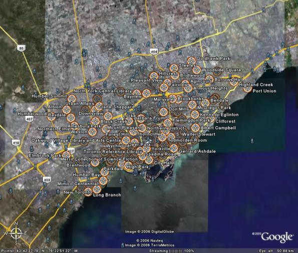
Catherine has a project involving Toronto’s libraries, and so I, for no particularly good reason, compiled a geocoded list of the Toronto Public Library system: libraries.gpx
Google Earth display of all of Toronto's public libraries

You can thank MapSource for the bloated GPX file. It quadrupled in size when I changed the symbols to look like buildings.

Toronto Subway Station GPS Locations, now in GPX

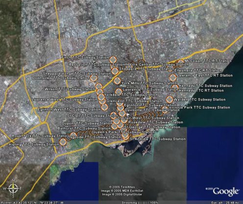
TTC stations on Google Earth
Further to Toronto Subway Station GPS Locations, I now have them in GPX format: ttc.gpx. Google Earth reads GPX files, but loses some of the metadata.

It would seem that someone has done this before, but using a different approach. I did search the forums, but there were no stations in the community overlay — honest, guv.

Toronto Subway Station GPS Locations

After seeing the various nifty web-enabled transit maps, I realised I had the data handy to get things started. A while back, I georeferenced the TTC Ride Guide, and digitized all the station locations. I cleaned them up today, and in the hope of being useful, here are the files:

These are simple three-column CSV files, stating latitude, longitude, and station name. They should be in order of stations. Locations are probably within about 50m of real life, but don’t bank on it.

I’ll get these into more useful formats soon, like GPX and KML. For now though, if you can use ’em, go ahead and do something.